
Network
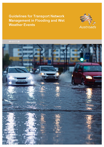
- Publication no: AP-G117-26
- ISBN: 978-1-923617-66-7
- Published: 2 September 2026
- PDF (free) Download
These Guidelines provide a risk-based framework to support transport agencies in managing the impacts of flooding and wet weather events on transport networks across Australia and New Zealand. Their purpose is to equip Traffic/Transport Management Centres, Traffic/Transport Operations Centres, and related stakeholders with practical guidance for preparing for, responding to, and recovering from flood-related disruptions.
The methodology is grounded in a 7-step risk management process aligned with AS ISO 31000:2018. This process encompasses context establishment, risk identification, risk analysis, risk evaluation, mitigation, implementation planning, and ongoing monitoring and review.
The Guidelines introduce purpose-built tools to support this process: an Impact Pathways Tool to map transport vulnerabilities and cascading consequences; Impact and Likelihood Scoring Matrices to evaluate and rank disruption likelihood and severity; and finally, Risk Mitigation Reference Tables that detail operational, preparedness, and strategic response actions. These tables are structured around the prevention, preparedness, response, and recovery (PPRR) framework.
The Guidelines address all road-based transport modes, including freight, public transport, active travel, and personal mobility, while recognising multimodal interdependencies. Key outcomes include strengthened operational resilience, improved cross-agency coordination, and integration of climate adaptation considerations into both real-time decision-making and long-term network planning, ultimately reducing disruption to communities and transport users.
Associated reports
These Guidelines have been informed by two reports, developed as part of Austroads project NEG6438:
- 1. Introduction
- 1.1 Purpose
- 1.2 Intended user
- 1.3 How to use these Guidelines
- 1.4 Scope
- 1.4.1 Austroads member agency roles and responsibilities
- 1.4.2 Out of scope
- 1.5 Key terms
- 2. Flooding and Wet Weather Definitions
- 2.1 Flood types, characteristics and classification
- 3. Context of these Guidelines
- 3.1 Principles for flooding and wet weather event management
- 3.2 Management of flooding and wet weather events by transport management centres
- 3.2.1 Traffic Incident Management
- 3.2.2 Multimodal Incident Management
- 3.2.3 Disaster and Emergency Management
- 3.2.4 Climate change adaptations
- 3.3 Stakeholders and partners to consider
- 4. Flood and Wet Weather Transport Management Process
- 4.1 Step 1: Establish risk analysis context and scope
- 4.1.1 Step 1 outputs
- 4.2 Step 2: Identify risks and vulnerabilities
- 4.2.1 Sub-step 2.1: Identify risk sources
- 4.2.2 Sub-step 2.2: Identify vulnerabilities
- 4.2.3 Flooding and Wet Weather Impact Pathways Tool
- 4.2.4 Step 2 outputs
- 4.3 Step 3: Analyse risks
- 4.3.1 Sub-step 3.1: Identify risk scenarios
- 4.3.2 Sub-step 3.2: Refine risk evaluation criteria
- 4.3.3 Sub-step 3.3: Analyse risk scenario impacts
- 4.3.4 Sub-step 3.4: Assess risk scenario likelihood
- 4.3.5 Sub-step 3.5: Develop risk ratings
- 4.3.6 Step 3 outputs
- 4.4 Step 4: Evaluate and prioritise risks
- 4.4.1 Sub-step 4.1: Prioritise risks
- 4.4.2 Sub-step 4.2: Apply additional evaluation criteria
- 4.4.3 Sub-step 4.3: Assess risk tolerability
- 4.4.4 Step 4 outputs
- 4.5 Step 5: Identify mitigations
- 4.5.1 Sub-step 5.1: Identify risk treatment options
Flood and Wet Weather Risk Mitigation Reference Tables - 4.5.2 Sub-step 5.2: Evaluate treatment options
- 4.5.3 Sub-step 5.3: Prioritise treatments
- 4.5.4 Step 5 outputs
- 4.5.1 Sub-step 5.1: Identify risk treatment options
- 4.6 Step 6: Develop implementation plans
- 4.6.1 Sub-step 6.1: Implementation planning
- 4.6.2 Sub-step 6.2: Monitoring and reporting (implementation oversight)
- 4.6.3 Step 6 outputs
- 4.7 Step 7: Monitor and review (ongoing risk management)
- 4.7.1 Sub-step 7.1: Performance monitoring
Note on performance monitoring and KPI alignment - 4.7.2 Sub-step 7.2: Periodic plan updates
- 4.7.3 Sub-step 7.3: Lessons learned and continuous improvement
- 4.7.4 Sub-step 7.4: Stakeholder engagement and reporting
- 4.7.5 Step 7 outputs
- 4.7.1 Sub-step 7.1: Performance monitoring
- 4.1 Step 1: Establish risk analysis context and scope
- References
- Appendix A Risk Register Template
- Appendix B Worked Examples
- B.1 Planning example – regional freight corridor (riverine flooding)
- B.1.1 Step 1 – Establish risk analysis context and scope
- B.1.2 Step 2 – Identify risks and vulnerabilities
- B.1.3 Step 3 – Analyse risks
- B.1.4 Step 4 – Evaluate and prioritise risks
- B.1.5 Step 5 – Identify mitigations
- B.1.6 Step 6 – Develop implementation plans
- B.1.7 Step 7 – Monitor and review (ongoing risk management)
- B.2 Planning example – CBD precinct flash flooding
- B.2.1 Step 1 – Establish risk analysis context and scope
- B.2.2 Step 2 – Identify risks and vulnerabilities
- B.2.3 Step 3 – Analyse risks
- B.2.4 Step 4 – Evaluate and prioritise risks
- B.2.5 Step 5 – Identify mitigations
- B.2.6 Step 6 – Develop implementation plans
- B.2.7 Step 7 – Monitor and review
- B.3 Preparedness example – small scale – rural causeway site (overtopping)
- B.3.1 Step 1 – Establish risk analysis context and scope
- B.3.2 Step 2 – Identify risks and vulnerabilities
- B.3.3 Step 3 – Analyse risks
- B.3.4 Step 4 – Evaluate and prioritise risks
- B.3.5 Step 5 – Identify mitigations
- B.3.6 Step 6 – Develop implementation plans
- B.3.7 Step 7 – Monitor and review
- B.4 Operational example – flash flood event
- B.4.1 Step 1 – Establish risk analysis context and scope
- B.4.2 Step 2 – Identify risks and vulnerabilities (Impact Pathways Tool)
- B.4.3 Step 3 – Analyse risks (Scoring Matrix)
- B.4.4 Step 4 – Evaluate and prioritise risks
- B.4.5 Step 5 – Identify mitigations (Reference Tables)
- B.4.6 Step 6 – Develop implementation plans
- B.4.7 Step 7 – Monitor and review
- B.1 Planning example – regional freight corridor (riverine flooding)